Agriculture is the backbone of Indian economy, providing livelihood and employment to about fifty seven percent of the population and contributing approximately twenty five percent to the GDP. Increasing population calls for efficient agricultural management for better utilization of land and water resources on a sustainable basis. In this context reliable and timely information of agricultural resources and their monitoring is very essential. Satellite remote sensing has the requisite potential to provide this information on a regular, synoptic, temporal, timely and in a more objective manner.
GIS application in agriculture such as agricultural mapping plays a important role in monitoring and management of soil and irrigation of any given farm land. Agricultural mapping acts as an essential tools for management of agricultural sector by acquiring and implementing the accurate information into a mapping environment. It also helps in management and control of agricultural resources. GIS agriculture technology helps in improvement of the present systems of acquiring and generating GIS agriculture and resources data.
Use of GIS in Agriculture Industry
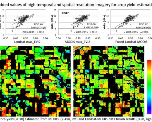
- Crop mapping yield estimation
- Crop assessment and Crop health
- Irrigated landscape mapping
- Application development for GIS agriculture
- Soil and irrigation amendment analysis
- Suitability assessment studies
- Erosion identification and remediation
- Agricultural mapping for detailed vegetation cover and monitoring
- Change detection studies and developing crop models
- Damage and land degradation assessment studies
- Elevation models for efficient drainage


