


Maxar Technologies
Adepto Geoinformatics is proud to be a partner of Maxar Technologies in order to promote its cutting-edge technology portfolio. These products utilize the latest innovations from Maxar and their partner ecosystem to give our customers unrivaled quality products and services.
Maxar has decades of experience manufacturing communication and Earth observation satellites—with more than 285 Maxar-built satellites and 2,750 cumulative years in orbit.
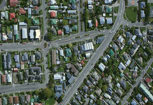
We serve the highest quality satellite imagery, base maps, and 3D data over any location on Earth. A near seamless and high-resolution view over large areas around the world. Skip straight to analysis with Maxar’s analysis-ready data (ARD).
ARD is preprocessed time-series stacks of imagery that are aligned and produced at a set standard. Aligned image stacks from ARD provide increased usable content via localized metadata, more accurate feature extraction, faster processing, lower storage costs, and homogenized inputs for analytic workflows.
ARD puts the user in control. Customize your imagery selection, order only what you need and deliver imagery directly to your cloud environment. Accessing Maxar’s highest-quality satellite imagery in analysis-ready format is easy with an API.
- Select imagery based on only the criteria that are important to your business. Choose your areas of interest, eliminate cloudy images, determine your stack depth, and more.
- Visualize your selected imagery stacks on an interactive HTML viewer.
- Review usage estimates before placing an order.
- Order only the imagery you select, relatively align pixels using Maxar’s proprietary Bundle Block Adjustment (BBA), and deliver GeoTIFFs and accompanying files to your preferred cloud environment.
- Access and interact with ARD imagery using Maxar’s Python-based SDK and CLI tools

ERDAS Imagine
Use ERDAS IMAGINE, the world’s leading geospatial data authoring system, supplies tools for all your Remote Sensing, Photogrammetry and GIS needs.
Erdas Imagine is an image processing software package that allows users to process both geospatial and other imagery as well as vector data. Erdas can also handle hyperspectral imagery and LiDAR from various sensors.

ERDAS APOLLO
is an extensive data management, analysis and delivery system allowing data to be distributed from the cloud or an in-house server.
ERDAS APOLLO provides comprehensive data management and delivery. This includes organizing geospatial and business data into a centralized library, and distributing that data from the cloud. Complete with a variety of delivery options, ERDAS APOLLO consistently delivers geospatial data faster and with less hardware than competing server-based products. ERDAS APOLLO can be customized and extended to satisfy both your geospatial and business process requirements.
Imagine PHOTOGRAMMETRY
IMAGINE Photogrammetry (formerly Leica Photogrammetry Suite – LPS) is a software application and very popular tool for photogrammetric related operations. It processes and extracts information from imagery. It is a leading commercial photogrammetry tool that is used by numerous agencies, regional mapping authorities, commercial mapping organizations. It is also widely used in academic research.
IMAGINE Photogrammetry is offered within the PRODUCER SUITE of the Power Portfolio. It maximizes productivity with state-of-the-art photogrammetric satellite and aerial image processing algorithms.
GeoMedia
It is a powerful, flexible GIS management platform that lets you aggregate data from a variety of sources and analyze them in unison to extract clear, actionable information.GeoMedia, a comprehensive and dynamic GIS software, extracts compelling intelligence from geospatial data to present actionable information.
Intergraph’s GeoMedia is a geographic information system application for working with and conducting analysis on geographic information as well as producing maps from that analysis.

WaterGEMS
Water Distribution Analysis and Design Software
OpenFlows WaterGEMS is an award-winning comprehensive yet easy-to-use decision-support tool for water distribution networks. This software helps in improving your knowledge infrastructure its reaction to operational strategies, and how it should grow as population and demands increase.
It analyses water quality simulations, criticality and energy cost etc. OpenFlows WaterGEMS has everything you need in a flexible multiplatform environment. We can help you with the study and analysis using this product in multiple ways.
WaterCAD
Water Distribution Analysis and Design Software
OpenFlows WaterCAD is a reliable decision-support capability for to design new water systems and manage existing water networks effectively to reduce disruption risks and energy use. OpenFlows WaterCAD’s ease-of-use helps you successfully plan, design, and operate water distribution systems:
- Increase capacity to adequate service levels.
- Supply clean potable water without interruption.
- Deliver high quality designs cost effectively.

OpenFlows FLOOD
Integrated Flood Modeling Software
OpenFlows FLOOD is a flood modeling software for understanding and mitigating flood risks in urban, riverine, and coastal areas. It uses fully spatially-distributed numerical models to simulate all hydrological and hydraulic processes that occur in river basins, including rainfall, infiltration, surface runoff, channel flow, and groundwater flow.
In urban areas, OpenFlows FLOOD can be connected to a model generated by OpenFlows SewerGEMS to simulate the surface and stormwater flow. Additionally, the model can be used to simulate flooding in coastal areas due to storm surges.