Our Services

Since inception, we have tapped into the most advanced technologies to create innovative solutions across industries and generate smarter systems that fits into your requirement. From agriculture to mining, transport to water distribution, we’re making a better world, arrive sooner.

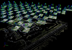
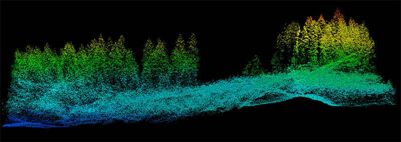
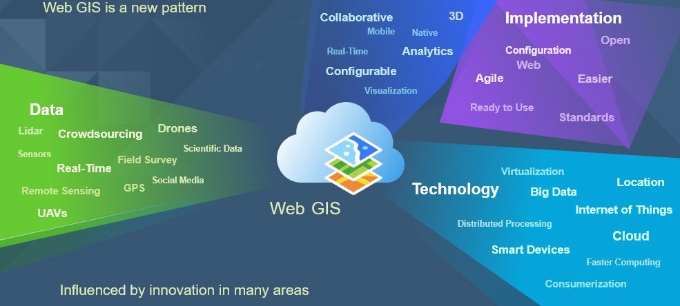
Adepto provides numerous GIS services to its clients all over the world. The GIS services rendered by ranges from visualization of geographic data, analysis of spatial relationships, and efficient data management. The GIS data conversions allow data from different sources to be merged in one common format, which allows for easy access, analysis and utilization. We have helped lot of organizations from multiple industries of Remote Sensing and GIS in last decade.

Our commitment to remain the world leader in the field of Geomatics have encouraged us to tap into the most advanced technologies to create innovative solutions across industries thereby making smarter systems and creating more intelligent world.

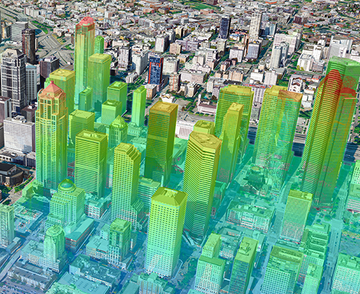
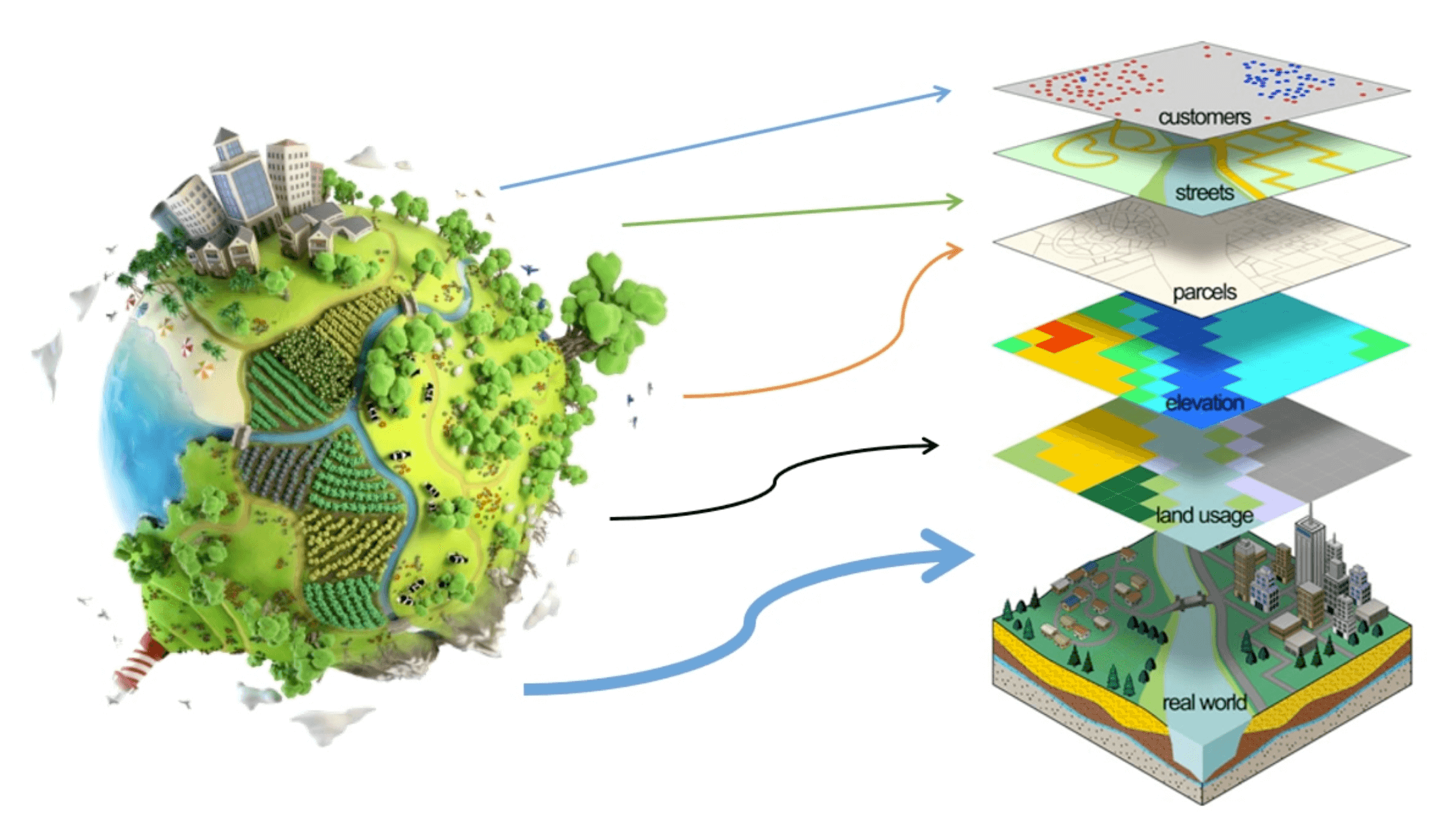
Our expertise and experience in integrating GIS, CAD and Global Positioning Systems (GPS) services, by using high-end GIS Mapping and GIS data conversions software, we assist the customers to produce contour maps, spatial maps, atlas maps, cadastral maps, thematic and zonal maps, landscape maps, and environmental maps for host industries such as mining and geology, utility, agriculture, petroleum pipelines, land information management etc.

OUR SERVICES ARE BLEND OF REAL-WORLD CHALLENGES OF OUR UNDERSTANDING TRANSFORMATIVE TECHNOLOGIES

GIS and Remote Sensing

GIS provides a spatial approach to organizing information and decision making tool for customers.

GIS applications are useful to analyze the spatial information for its customers to improve planning, management, operation and maintenance of its facilities. We help our customers in implementing GIS technologies in multi scale and agile environment.

Photogrammetry

It is the science of making measurements from photographs. The input to photogrammetry is photographs, and the output is typically a map, a drawing, a measurement, or a 3D model of some real-world object or scene. Our Services includes from Aerial Photography, Digital Aerial Triangulation (DAT) production, 3D Vector Mapping, Terraing Modeling, Orthophoto generation and rectification.

Lidar Data Processing

In the recent times, use of lidar has increased, and for good reason. The technology can produce higher-quality results than traditional photogrammetric techniques for lower cost. This is somewhat accomplished, by the automated collection of measurements that are sampled very densely.

The progress in laser scanning hardware has been good. However, a biggest side effect of switching to lidar-based technology has been the challenges associated with increasing data volume and the expansion of software processing capabilities needed. We have specialized solutions that offers many tools for managing lidar point clouds and deriving useful products from them to aid scientific research and decision making.

Custom App Building

Mobile GIS is taking Geographic Information Systems (GIS) out of the office and into the field. A mobile GIS allows folks out in the field to capture, store, update, manipulate, analyze, and display geospatial data and information. Our technical experts and developers can help you to make your application as per the need. This can be for any opensource based application or using any COTS technology.

3D City Modeling

The 3D city model is based on geodata, DEMs (digital elevation models), orthophotos, buildings from survey maps, architecture models, vegetation data, land-use plans etc. which are increasingly available in an up-to-date, area-wide and high quality manner for the whole urban area. Adepto uses very high end 3D city modeling software’s which do most of the job automatically with very high efficiency and quality.

Web GIS

We customize, design and create web GIS applications using a wide variety of resources, and your end users will use these applications to address any number of questions, missions, and problems. Web GIS is a type of distributed information system, comprising at least a server and a client, where the server is a GIS server and the client is a web browser, desktop application, or mobile application. In its simplest form, web GIS can be defined as any GIS that uses web technology to communicate between a server and a client.

Training Services

Skill your workforce in new age technologies with our latest state of art customized curriculum. Our experts from specialized training program can help you to be updated with latest technologies in GIS and Remote Sensing. Acquire the highest quality image sample sets. Use a method grounded in measurement science. Understand rule-based methods that minimize and quantify measurement uncertainty. Visit Our Training Portal GISCampus.in

Environmental Impact Analysis

Environmental Impact Analysis is an important policy initiative to conserve natural resources and environment. Many human activities produce potential adverse environmental effects which include the construction and operation of highways, rail roads, pipelines, airports, radioactive waste disposal and more. GIS can be useful to analyse the environmental impact to contain specific information on the magnitude and characteristics of environmental impact. These kinds of analysis can be carried out efficiently by the help of GIS, by integrating various GIS layers, assessment of natural features can be performed. We help the organizations to perform these kinds of study and analysis.

Disaster Management with GIS

India is vulnerable to natural and manmade disasters. All disasters are spatial in nature. GIS solutions act as a decision support tool thereby helping in decision making by analysis of different GIS layers. Currently socio-economic and geo-spatial data is useful for management and planning of disasters as well as tackling of disastrous condition. Various Government departments and agencies who are stakeholders are using GIS now a days in the disaster management process. 

GIS is useful for hazard zone mapping and during emergency conditions mitigation of people can easily possible using this maps. GIS and Remote Sensing is much beneficial in mitigation strategies and preparedness plans. Real time geographic data can improve the allocation of resources for response. 

Our Workflow…

AGILE WORKFLOW

Latest technology, research and innovation that are implemented by highly experienced and qualified engineers, geo-scientists, planners have developed our GIS solutions, integrated with GPS, GIS, and CAD. We design system and architect them to follow AGILE. Management and maintenance, map production and analysis (specialized for GIS mapping agencies also), database design and development, user training and support, and 3d modeling and visualization, proper approval process, internal project management and deployment.

What you need to provide…

EVERYTHING STARTS WITH GOOD DATA

We invest in and deploy the latest and most advanced technologies, platform and softwrares which can be customized as per the need. We study your data, your requirement and our experts gives you possible solutions of your requirement. We suggest the cost effective solution which is the most suitable as per your need. Our engineers are good at analyzing the data and give you a glimpse of projects outcome.