About us

Adepto Geoinformatics Pvt. Ltd is a company that specializes in custom development, surveying, and data Protection and GIS mapping and application development. Established in 2007, we have since expanded our services reach across the India and abroad. The philosophy of the company is to provide quality individual business solutions through bespoke software and database development along with data backup and protection in order to forge long term strategic partnerships with our clients.

Our software development expertise covers the full software life-cycle from business requirements through feasibility study, specification, analysis, design, prototyping, programming, testing, deployment to on-going support and enhancement.

Vision:

Our commitment to remain the world leader in the production of Geomatics. We believe that we can make a difference where ever we do business by producing quality product and working with long term association with all our partners across the globe.

Quality Standards:

We are committed to delivering all our services to the highest quality standards. We achieve this with boring regularity by applying our quality management system (QMS) Quality solved to all projects. In addition to careful specification, high quality development and rigorous testing, we aim for the highest possible quality in our dealings with you. Our policy is to only take on orders that we can deliver using available resources to ensure maximum commitment to your projects and to meet our guaranteed delivery to agreed deadlines. We have specialized skills for Hexagon suite of products and we trust the quality of data produced for surveying and software development.

Our Expertise:

With a proven track record of our team over more than two decades of experience in sales and distribution of geospatial products, services and web application development, testing and supporting application products they understand the trials of product development you need and bring this experience to the partnership. We help our customers optimize their reserves in scientific applications Remote Sensing and image Processing, Technical Computing and Modeling and photogrammetry using products of the market leaders. With expertise derived from deep product relationships with scientific application leaders, we offer sales and distribution through our office and extensive network through out the country and application development and value added services. The people involved with us are having vast experience in their respective domains.

Quality:

Adepto follows global quality standards for Mapping with the ISO 9001:2008 certificate along with well experienced professionals.
a) National Map Accuracy Standards (NMAS)
b) American Society of Photogrammetry and Remote Sensing (ASPRS)
c) National Standards Spatial Data Accuracy (NSSDA)
d) Federal Geographic Data Committee (FGDC) metadata standards
e) European Standards (MAP-ESG)

OUR TEAM

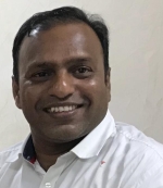
Bhaskar Kannoju

Founder and CEO

An Innovative thinker, Mr. Bhaskar Kannoju, has done M.sc Geology (Osmania University) and M.Tech specialization in GIS and Remote sensing from JNTU Hyderabad, having more than two decades of rich experience in various scientific projects in Geospatial domain . His professional career begins from multinational companies such as Hitachi Consulting erstwhile Sierra Atlantic and Hexagon Geospatial erstwhile Intergraph. His innovative thinking and sincere efforts make him to start Adepto Geoinformatics Pvt Ltd in 2011.He has travelled across the country for several times, having prominent presence at Government, Defense, Space and R&D Labs etc., and travelled more than 10 countries such as USA, Singapore, Malaysia, Hongkong, Vietnam, Thailand, Kenya, Bhutan, Madagascar and Macau etc. He has published national and international papers on GIS applications for various sectors. He has experience in Geospatial domain and Scientific Research Organizations. He is associated with several National and International Organization in the GIS industry. He has a Life membership of Indian Society of Remote Sensing -Dehradun, Indian Society of Geomatics, ISRO-Ahmedabad, Indian National Cartographic Association, Survey of India - Hyderabad.

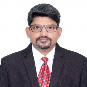
Sailendra Kumar

Vice President – Business Strategy (Geospatial)

Mr. Sailendra Kumar has done M.Sc Geology( Earth Sciences ) from Sri Venkateshwara University Tirupathi, Andhra Pradesh. Having wonderful rich experience of more than 20 years and executed various roles in geospatial industry. His core expertise in Sales and Marketing handled various Geospatial software products and services for the Government, Défense and Corporates at National and International levels. He is also responsible for global partnerships with companies associated with geospatial products and services along with corporate strategy activities.

Wing Commander S Vijay

Advisory Board Member

S Vijay is a B.Tech graduate in E&C Engg. (1993) from JNTU, Hyderabad. He did a PG certification course in Aeronautical Engineering from prestigious Air Force Technical College, Bengaluru.
He is also certified on Lean Six Sigma (Green Belt) and Business Management from Administrative Staff College of India.
He has held many important command & staff appointments in his 23-year service career.
He has extensive experience in Operations, Aerospace Technology and Project Management. He is qualified on all variants of Surface to Air Missiles in IAF, Kiran Trainer aircraft, Electronic Warfare, Searcher Mk-II and Heron UAVs. In the year 2007, he presented a paper on collision avoidance system for UAS at World UAS Conference held in Paris. In 2010, he was deputed to NTRO under PMO as a Group Director (Engg) for induction and operationalisation of Satellite Communication UAVs for internal & external security role. He is trained on Satcom enabled Heron UAVs at IAI, Tel Aviv. Currently he is mentoring emerging organizations in drone technologies

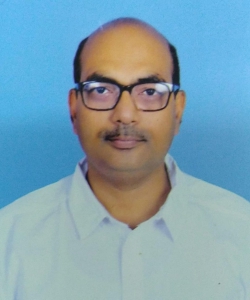
Krishna Chaitanya

Vice President (Geospatial Operations)

Highly Experienced Geospatial Professional with commercial skills and deep roots in geomatics, surveying, data management, mobile mapping and 3D modelling.

Krishna Chaitanya Battala is an Engineering Graduate and passionate about GIS and mapping services who combines 17 years of geospatial industry, experience with C-Level business management and consulting skills.He has received prestigious awards from World Bank and International Mining Association for his exceptional contribution.

Srinivas Pogaku

General Manager Geospatial Global Services

Mr. Srinivas Pogaku has contributed over 17 years of rich experience to the Geospatial Industry in India. His extensive knowledge of GIS brings appropriate solutions to the clients in Telecom Geodata, Remote Sensingand Utilities etc. He worked in multinational companies and having great in depth of experience for diversity of international Geospatial Projects, gets involved in Process Re-engineering, QMS Implementation , Deliverables. He is the overall Head of Geospatial Operations for International Business Development.

Sudhir Reddy Kura

Head - IT Operations

Electronics Engineer has rich experience in Information Technology. He holds bachelor’s degree in engineering from the JNTU Hyderabad University. Prior joining Adepto, Sudhir Reddy holds technical experience from multinational companies. He has extensively worked in various IT domains like networking, ERP, Database and software solutions. Mr. Sudhir Reddy Kura is Head in-charge of entire IT operations, Quality & Process.

Vijaykumar Singh

Advisor and Consultant

Vijaykumar Singh, (IT- Consultant) holds a Management Degree from Pune University and has more than 30+ years’ experience in Senior Management working with RelQ Software Pvt Ltd, Bangalore (Now Hewlett-Packard-HP), HCL Technologies Ltd and Windata Solutions Limited.Was involved on evaluating the Sales, Delivery Process, Pre-Sales & Business issues, as a Business Unit Head, involved in Product, Process Management overseeing the smooth Delivery process, Transition management, SOA, Due Diligence, Cloud and Quality Compliance.
Implemented CMMI, Six Sigma initiatives in few of the projects, managed around 30 projects in different verticals like Healthcare, Government, Geographical Information Systems, E-Commerce, Transportation, Telecom, Media Publishing, Entertainment, Retail and Gaming.

Musinipally Anand

Advisor and Consultant

MBA degree holder, archiving of films and news papers into storage space for posterity and library use. Dream, Designs & Digital has been his main stream achievement.

Sudhakar P

Consultant

P Sudhakar’s experience varies from GIS engineer to Project management to GIS Consultant, includes property survey (20+ Cities) & house numbering (30+ Cities), preparation and updation of GIS base maps (35+ cities), Utility survey & consumer data collection (11 cities) , village level survey for land records (1 District In Gujarath State), village level survey for planning of optical fiber cable laying (680 Panchayats of Guntur district), GIS projects like road information system (2 States), water shed digitization, contour digitization etc.
Distinct experience spanning various roles in my career of 19+ years helps me to understand the need of the client & organization to achieve the goals as per the mission and vision. Also, in optimizing Technical Operations to Strategic Business development for Government/Private Industry gives edge on rest.